I’m finally back to documenting our most recent trip with the caravan.
After the Mundi Mundi bash, our plan, such as it was, was to finally explore a bit of South Australia. We have been jinxed the last couple of attempts, so let’s see how we went this time.
The obligatory photo at the border.
We travelled this first part last year on our big trip to the north, so I’ll just pop in a few photos.
Our destination for the next three nights was the tiny town of Wilmington. Firstly, to catch up on the washing and then to have a bit better look around this area that we had previously just driven through.
The weather on our first full day there was scattered showers, so we decided to have a drive around the area, visiting some other tiny towns that aren’t on the main road.
The season down here had been excellent so far, with beautiful wheat and canola crops. The yellow against the backdrop of Mouth Remarkable National Park was incredible. Sadly, these seasons are not the norm.
The landscape is dotted with ruins of stone cottages. They are rather picturesque. However, they are a sign of the many early settlers that were unable to survive in this harsh state, which is considered to be the driest state in the driest country.
We saw a sign to a historic marker and found this rather non-descript cairn and plaque. Zoom in to read the plaque. It is rather interesting. George Goyder surveyed the line, based on the native vegetation in response to the severe drought years of 1862-1863, which resulted in many of the early settlers walking off their land, having been settled to the north in previous years of good seasons. The land north of the Goyder Line was considered only suitable for grazing and not for crops. Wilmington is just north of the Goyder Line.
There were lots of creeks and they were lined with huge river red gum and park like grass. (This is actually a crop.) As I said earlier, this year has been a wonderful season and you can see why those early pioneers settled where they did.
The first little town we visited was Melrose and they had a very informative museum, housed in the old Police Station and Courthouse. When it was established in 1862 it was the headquarters of an area larger than England, covering most of South Australia and all of the Northern Territory. It finally closed in 1967.
One building covered the agricultural industry. The Goyder Line featured quite a bit. The years following the drawing of the line were quite abundant, so farmers started to see it as irrelevant and started to move further north again. They felt the climate had changed and some had the misguided belief that if you ploughed the soil, the rain would come. Sadly, not only was that not the case, if the rains did not come most of the top soil would be blown away.
There was a timeline on one wall with diary extracts for the next 30 years or so. There were some good years, but there were more years with severe droughts, mice plagues, locust plagues, crop diseases and rabbits. Of course, this resulted in more people walking off their farms.
In modern times, with better understanding of the climatic conditions, better crop varieties and better farming practices, there are many successful properties above the Goyder Line, but such farming continues to be a gamble.
Some innovative people came from the area, developing new harvesting machinery.
As usual, I was drawn to the section on women. Please zoom in and read this letter. How hard must it have been in those early years.
I imagine her little slab hut would have looked something like this, minus the stove. She would have cooked over an open fire.
There were some lovely old buildings in the town. It is really popular with mountain cyclists, as Mount Remarkable is just out of town.
I came across a very colourful Book Exchange
To my delight, there was a vintage book in excellent condition that was set in this area. “Sheepmates” was published in 1931 and tells of an English fellow who worked his passage to Adelaide and then ended up working on a sheep station in the very north of South Australia. So many things that were referred to in the museum were relevant in this story. I thoroughly enjoyed reading it. This is definitely a keeper.
Back on the road we came across a couple of other picturesque stone ruins.
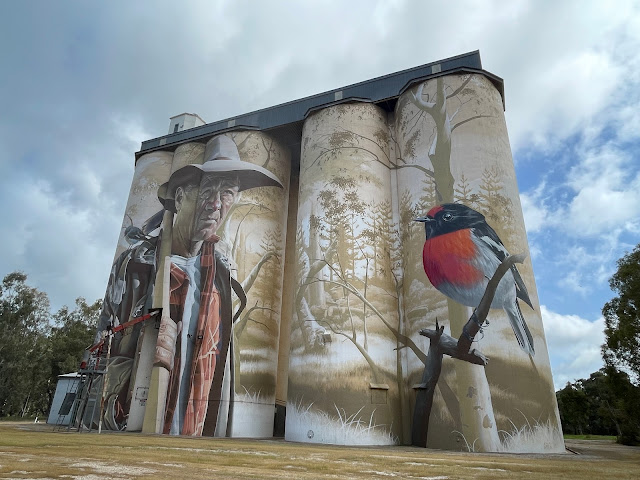
The next little town we came to was Willabarra.
Its latest claim to fame is some silo art. I really like this one. The artist is SMUG (aka Sam Bates).
I love the little red capped robin. Apparently, the farmer is no actual person.
We had to take a photo of the ute in front of it.
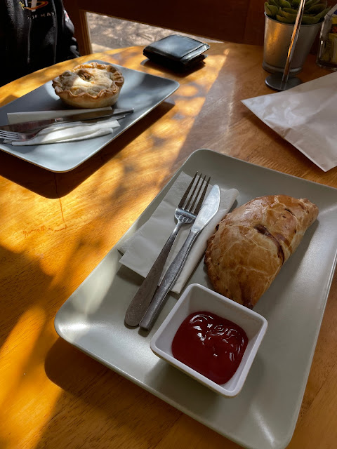
At the tiny locality of Stone Hut there is a bakery, which is known for its pies. Perfect timing for our lunch. Mick had a lamb pie, while I had a pasty. They were both delicious.
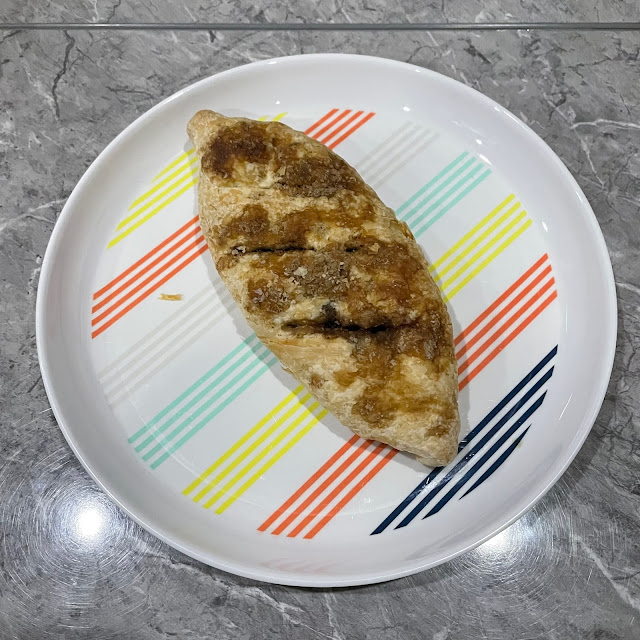
We were surprised to see that they sold Eccles Cakes, so we took one home for later.
The next little town on our travels was Laura, which is slightly larger than the other two, but still very small, with some more interesting old buildings. Sadly, most of the storefronts were empty.
The poet CJ Dennis spent some of his youth here and is celebrated with a sculpture in the main street.
From here, we decided to drive through the Germein Gorge, which was twisty and pretty.
We popped out near the small seaside town of Port Germein. Yes, we were quite close to the coast, Spencers Gulf, to be exact.
It’s funny how so many small towns have some claim to fame. This time it is the longest timber jetty in the Southern Hemisphere, at 1,680 metres long when it was built in the 1880s. It was built that long as the tides go out a long way. It is now 1,532 metres long and the last small section is closed to the public.
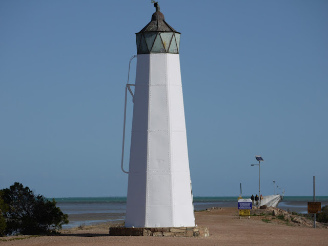
There is even a small lighthouse. You have to love a lighthouse. This one is made from steel and was originally located at the end of the jetty. It was relocated in its present spot in 1975 and restored in 2014.
From here it was back through Germein Gorge and then a little dirt road back to Melrose and Wilmington.
However, our day of playing the tourist wasn’t over yet. We continued on past Wilmington to Hancock’s Lookout. We had been told this is a great place to watch the sun set, and it was.
You look over to top of Spencers Gulf towards Whyalla. There were a couple of vans camped up there for the night.
Mick even noticed two galahs in a nesting hollow in one of the trees.
As you can see, the overcast, showery weather had cleared to a fine evening, which boded well for the next day of exploring.
We ended up driving about 200kms on our little jaunt. Not a bad effort. It was one of those perfect days that we will remember fondly.


7 comments:
Fantastic jaunt Janice! Great photos, wonderful silo and amazing sunsets! Thanks for sharing your travels.
What a wonderful trip to follow along with you. Amazing to read about.. Thankyou.
Another wonderful post, Janice. Yes I think most little tiny towns have some claim to fame. THat silo art is magnificent. I read the letter and the pioneering days are very similar to life in early Canada. Illness and death surrounded them it seems and of course, the endless hard work. Women are strong, there is no doubt of that. Lovely food and thanks again for sharing your photos. So interesting!
I love that bit of travel to places I have never been.... and some really lovely pictures too...
Hugz
another fine mini trip you have taken me on...
Such an interesting post, Janice. I do often marvel at how our ancestors lived - and what the pioneers went through to survive and try and make a better live for themselves. Your writings remind of just how big Australia is! PS The canola field photos are gorgeous, as are the ones of the special sunset!
I have started my catchup of your posts with your SA travels. this is country I do know a bit of. I remember staying at Port Germein one time and all the mosquitos that were there too!!!
Post a Comment