We have three full days here to explore Uluṟu and The Olga’s and started our exploring early yesterday morning. The clouds of the day before had completely cleared.
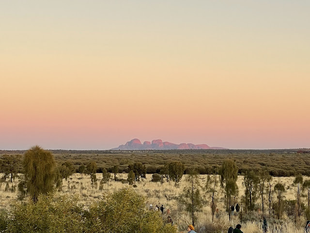
After a quick breakfast we drove out to the sunrise viewing point. We could have been a little earlier to catch the silhouette of the rock.
Everyone was taking photos of other people, rather than trying to get a selfie to work.
There were quite a few people there, including a few tour buses.
It was nice watching the colour start to show on the rock and also on the vegetation.
We could also see the Olgas in the distance glowing in the morning sunlight.
On our walk back to the car we noticed our first of several beautiful seats made from local timbers.
Our plan was to then walk around the base of the rock, a distance of 10.6kms. We started off on the southern side, which was in the shade and quite cool, walking in a clockwise direction.
Where does one begin to tell about this incredible place? The rock is huge and with a surprising (to us) amount of trees and other vegetation around its base.
Where rocks have fallen away there are many caves. This has happened so long ago that such features form the backbone of many aboriginal teachings and lore. I will plead ignorance here, as there are too many stories to remember.
There are several sections as you walk around the base that you are not allowed to take photos of. They are clearly signposted to let you know. There is so much else to photograph, that this is no inconvenience at all, and a common courtesy.
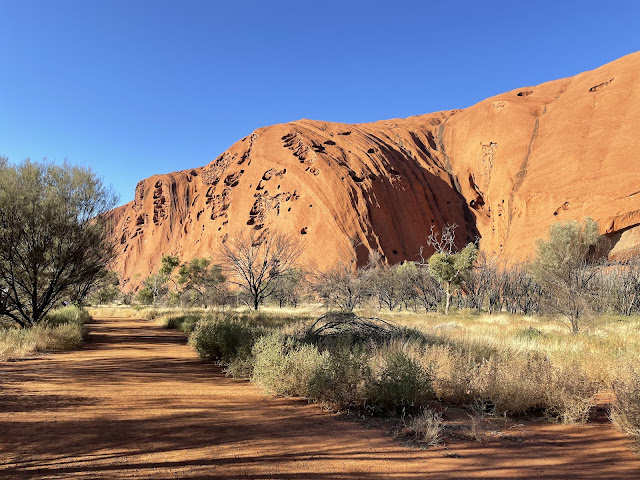
The colour of the rock varies as you walk around. It is constituted of a sedimentary rock called arkose sandstone, rich in the mineral feldspar. The iron minerals in the rock are weathered by water and oxygen, which creates a similar effect to rust. Where it isn’t weathered, such as in caves, it is grey. It appears quite flaky in places. Note the little willy wagtail on the rock.
Despite being a very popular spot, there was plenty of room for everyone and it was remarkably quiet and peaceful.
Everything man made was created to make it blend with the landscape. Handrails and bridges were painted the same colour as the soil, shelter sheds had a bough roof and even the toilet block was curved and made from mud bricks.
We reached the spot where you used to be able to climb the rock. This practice ceased in October 2019 as it was considered to be desecrating a sacred place. There was a bit of an outcry by some at the time and a mad rush by many to do the climb while they could. My dad climbed it when he was in his 70s and my brother had also climbed it many years ago. Someone mentioned to us that they had been told that as there were no amenities at the top of the rock and it took a while to make the climb, that some people did number ones and number twos up there, which were then washed down into the waterholes when it rained causing them to become toxic. Yuck! That is reason enough to close it down in my opinion.
I think that walking around the base is just as nice, if not nicer.
As we came around to the northern side of the rock the temperature increased considerably and the vegetation changed, not being a lush. As you can see, the path is nice and wide and easy to follow.
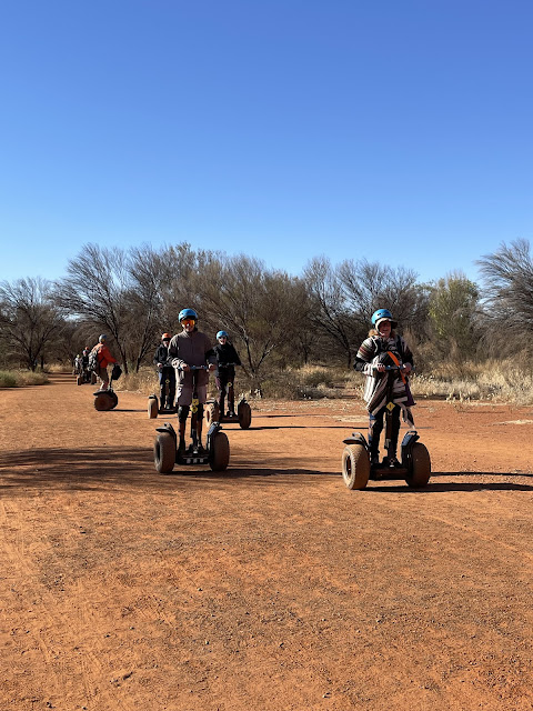
As well as walking, you can travel around the rock by Segway. There is a company that does tours.
You can also cycle around, either on your own bike or you can hire one. We saw heaps of them, nearly all hired.
One one part of the rock there is a very prominent marking, which we reckon looks like an aboriginal man’s head. I’m sure it has a story behind it, but I don’t know what.
While we walked around we heard lots of birds. The zebra finches were madly twittering away and flitting here and there. Their presence is an indicator that there is water nearby. We also saw some singing honeyeaters on grevillea flowers. Of course, none sat for their portrait.
As we returned to the southern side of the rock and completed our lap, we made one more detour, into the Muṯitjulu Waterhole. It is in a deep gorge and you can see how the water runoff from the rock is funnelled down into this spot. It was used by the traditional owners as a spot to hunt prey as they came for water. They would wait till they had drunk and when they were leaving would hunt the last of the animals. That way, the others would be unaware and not be scared to return to the spot. Rather clever.
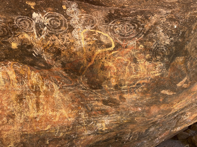
There were a couple of caves in the area. One was used as a training place for young men. There are still paintings visible on the walls. The only ones I know the meaning of is the concentric circles, which mean waterholes.
After our walk we returned to the van for lunch and then went down to get a couple of items of groceries. After all that walking we thought we deserved coffee and warm brownie. One between us was sufficient, as it was rather decadent.
Then it was time to go back to the van and prepare for our evening. More on that soon.


Nice
ReplyDeleteWhat a fascinating place!
ReplyDeleteawesome sight and photos...cross it off your bucket list!
ReplyDeleteIsnt it an amazing place! When we were there climbing Ularu was still happening, but being discouraged, so I'm pleased it is now banned. We stopped at a roadhouse on our coach trip and were told the story of the man who was commissioned to install the chain up the rock at waist height. Seems he was a real little short nuggety guy, and that's why the chain was so low, it was installed to suit him!
ReplyDeleteLooks like a beautiful day and a beautiful walk. With so many visitors I can see why the local people wanted a little more respect for their land, especially after the story you tell of some people who climb to the top.
ReplyDeleteOne thing most indigenous peoples get right is how to live with and respect nature.
Fabulous....
ReplyDeleteHugz
You did great with that walk
ReplyDeleteIt is an amazing place Janice, we were there when they boys were young, there was a sign asking people not to walk but lots were still doing it. David and Adam went up and Shane and I didn't, we did a walk around the base too.
ReplyDeleteA great walk
ReplyDelete